
Worldwide volcano guides
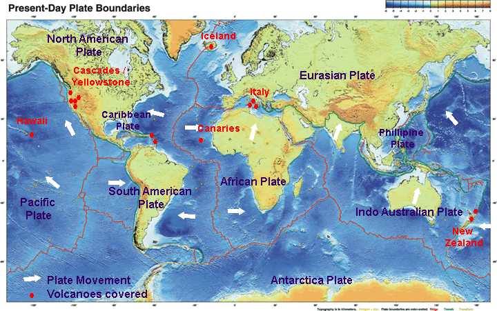
Volcanoes are found all over the world these guides will tell you about the volcanoes cause,geology,eruption history. If you are planing to visit a volcano whether to climb, sample the hot springs or just look in wonder then the "Things to do section" will provide you with all the best volcanic sites to see.We've included some of the worlds most famous,infamous and popular volcanoes. European volcanoes such as Etna and Vesuvius,Hawaiian volcanoes such as Kilauea, the awe inspiring Mt St Helens ,New Zealand Volcanoes such as Taupo, Mt Tarawera ,White Island and the Caribbean volcanic island of Montserrat.
Volcano Index
Remember we also have a volcano casestudies section perfect for school projects. We re still working on Japan,Costa Rica,Mexico,Africa,Indonesia and the Rest of the world. So many volcanoes so little time!
Click on the map below for volcanic regions or use the table for specific volcanoes.